Zhengyang Wang · Personal website
Skip to content
Zhengyang Wang / 王正旸
AboutResearchNewsApplyingLifeCV

Search website

Browse profile and research

AboutAbout Zhengyang WangI am a Computer Science and Technology undergraduate at Beijing Normal-Hong Kong Baptist University, with expected graduation in June 2027. My research experience covers computer vision, mobile RGB-D measurement, hydrological modelling, multimodal reasoning, indoor localisation and cardiac image segmentation.ResearchMapAgent: Indoor Localisation and Spatial ReasoningMapAgent is an ongoing final year project exploring language-model agents for indoor localisation and spatial reasoning.ResearchMetroHeight: Mobile RGB-D Cargo Height EstimationMetroHeight explores smartphone RGB-D sensing for cargo-height measurement on delivery trolleys in metro stations.ResearchHydrological Constraints on Post-Fire Vegetation RecoveryThis project examines how soil-water conditions relate to vegetation recovery after the Gospers Mountain megafire.ResearchSpatiotemporal Flood Forecasting and Hydrological ModellingThis project studies regional river-discharge forecasting through hydrological observations and spatial information.ResearchCardiac Segmentation and Spatiotemporal ModellingST-Net studies cardiac cine MRI segmentation using temporal information when segmentation labels are limited to selected cardiac phases.ResearchVisual Metaphor and Multimodal ReasoningThis project studies visual metaphor generation and reasoning in multi-agent communication games through MetaVision-DB and MACH.ResearchResearch and Development of Third-Generation Intelligent Arrow Selection Equipment and SystemsData-driven arrow selection connects visual measurements with shooting performance. This work supports the analysis of arrow dispersion and stability across rounds.

Search is processed on your device. Press Esc to close.

中文
AboutResearchNewsApplyingLifeCV
Research Projects

04 / 07 · Environmental AI · Time series

Flood Forecasting

Spatiotemporal Flood Forecasting and Hydrological Modelling

This project studies regional river-discharge forecasting through hydrological observations and spatial information.

Role
Method development · Second author of conference abstract
Period
Sep 2025 – Sep 2026
Supervisors
Huaxiong Huang · DKU / Zijian Wang · BNBU

Poster abstract accepted · WRE 2026

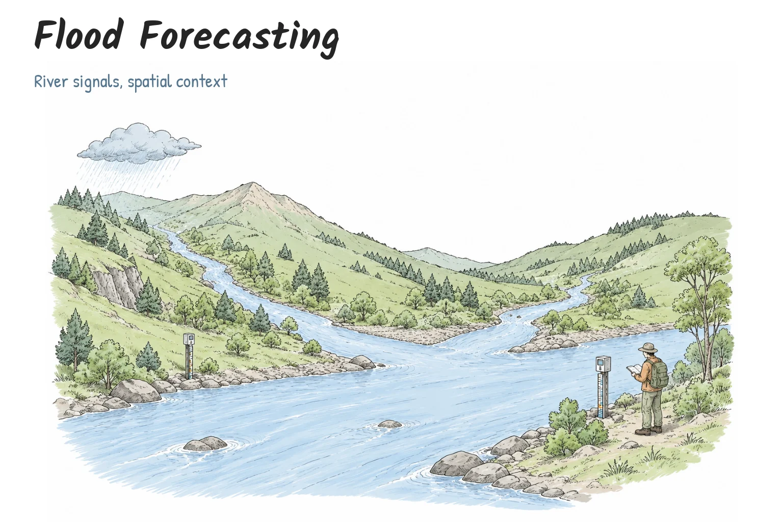
Hand-drawn river catchment with observation gauges, rain and terrain
View illustrationEnlarge

Image viewer

100%
1 / 4

Hand-drawn river catchment with observation gauges, rain and terrain. Conceptual illustration.

Scroll to pan · + / − zoom · 0 reset · Esc close
Hand-drawn river catchment with observation gauges, rain and terrain. Conceptual illustration.

Contents

OverviewHow it worksSelected contributionsResearch status
Contents
OverviewHow it worksSelected contributionsResearch status

Overview

Improve the representation of river dynamics in regional flood-forecasting research.

How it works

The current Hybrid4 configuration averages four members with equal weights in physical discharge space: three event-aware raster Transformers with different random seeds and one persistence-residual histogram gradient-boosted tree model. Inputs combine gauge observations, ERA5-Land reanalysis and spatial rasters. Forecast-horizon ERA5-Land is supplied in this retrospective setting, so the illustration describes reanalysis-assisted evaluation rather than an operational weather-forecast deployment.
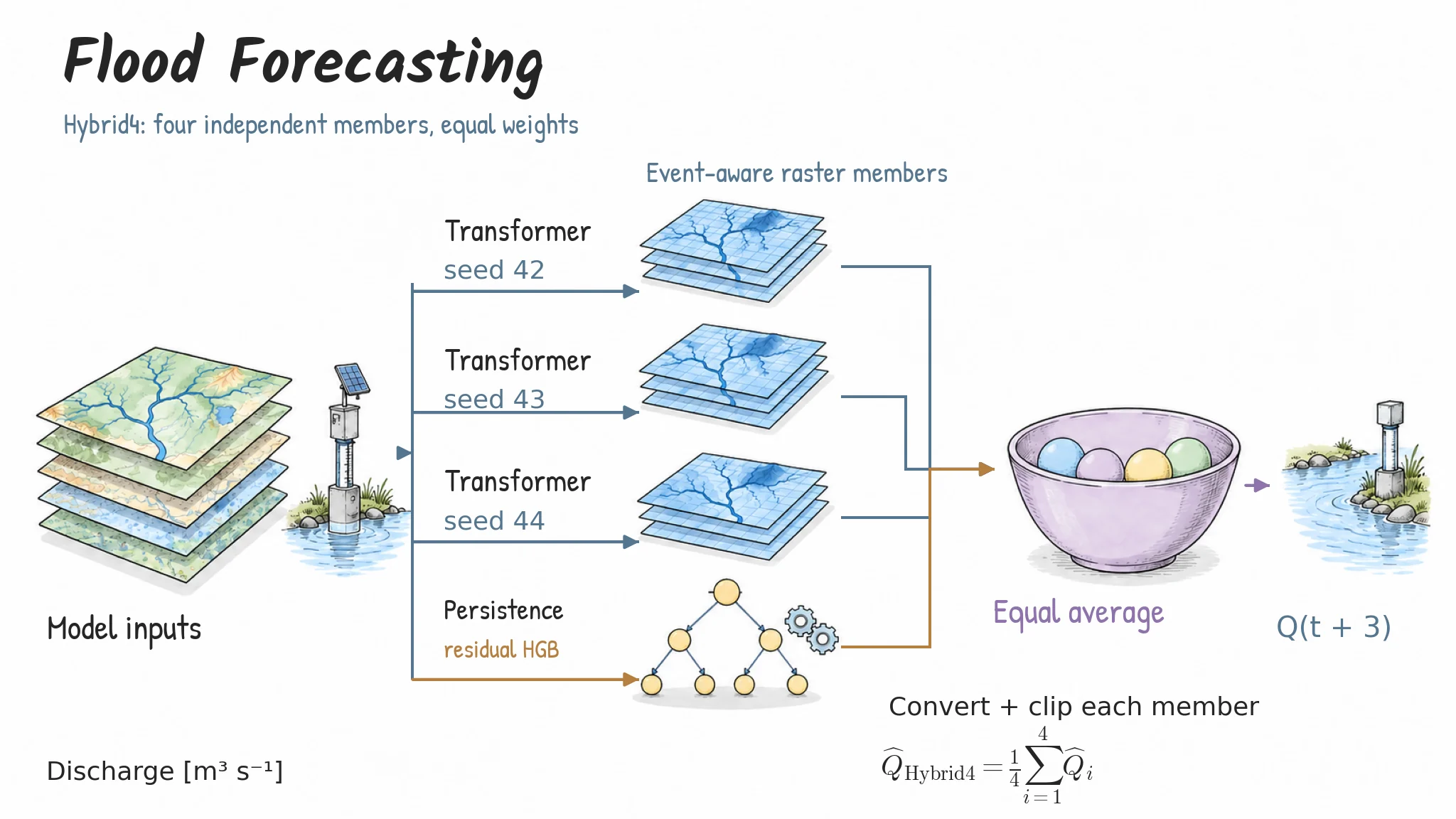
Three event-aware raster Transformers (seeds 42, 43 and 44) and one persistence-residual HGB member are converted to physical discharge, clipped and averaged with equal weights.
View illustrationEnlarge

Image viewer

100%
2 / 4

Hybrid4: four equal members — Three event-aware raster Transformers (seeds 42, 43 and 44) and one persistence-residual HGB member are converted to physical discharge, clipped and averaged with equal weights.

Scroll to pan · + / − zoom · 0 reset · Esc close
Hybrid4: four equal members

Three event-aware raster Transformers (seeds 42, 43 and 44) and one persistence-residual HGB member are converted to physical discharge, clipped and averaged with equal weights.

AI-assisted method illustration
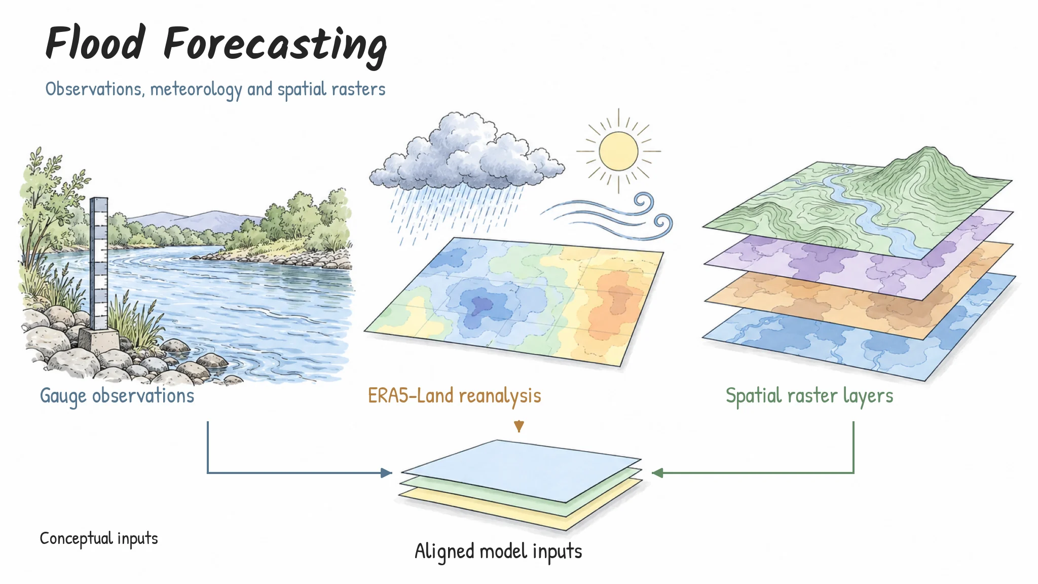
Gauge observations, ERA5 reanalysis and geospatial raster layers provide temporal and spatial context. These are schematic inputs, not exported research data.
View illustrationEnlarge

Image viewer

100%
3 / 4

Observations, weather and space — Gauge observations, ERA5 reanalysis and geospatial raster layers provide temporal and spatial context. These are schematic inputs, not exported research data.

Scroll to pan · + / − zoom · 0 reset · Esc close
Observations, weather and space

Gauge observations, ERA5 reanalysis and geospatial raster layers provide temporal and spatial context. These are schematic inputs, not exported research data.

AI-assisted method illustration
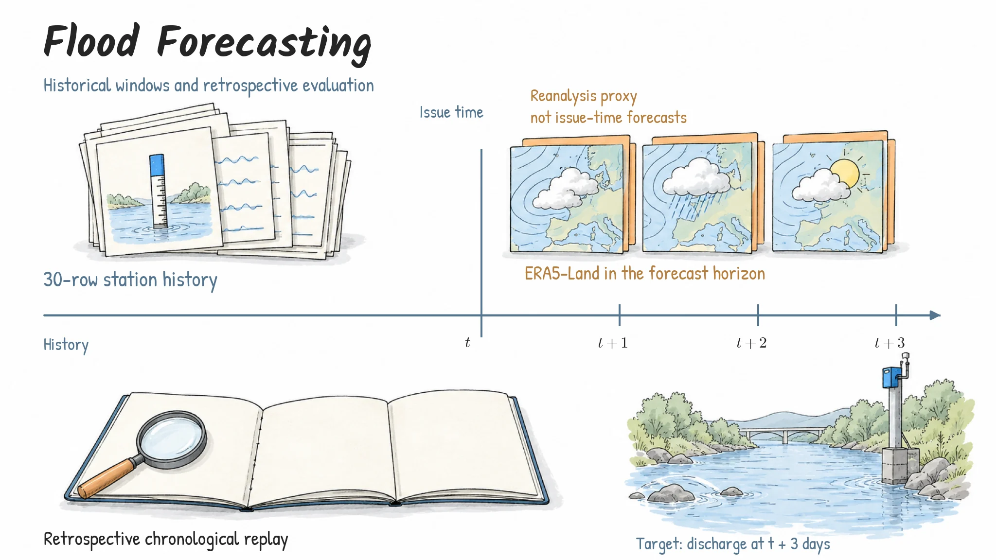
Historical observations precede a three-step discharge target. ERA5 values in the forecast horizon are available as retrospective reanalysis; operational forecasting would require a corresponding weather-forecast input.
View illustrationEnlarge

Image viewer

100%
4 / 4

A retrospective forecast setting — Historical observations precede a three-step discharge target. ERA5 values in the forecast horizon are available as retrospective reanalysis; operational forecasting would require a corresponding weather-forecast input.

Scroll to pan · + / − zoom · 0 reset · Esc close
A retrospective forecast setting

Historical observations precede a three-step discharge target. ERA5 values in the forecast horizon are available as retrospective reanalysis; operational forecasting would require a corresponding weather-forecast input.

AI-assisted method illustration

Selected contributions

  • Developed a forecasting approach that represents river-network relationships.
  • Integrated reanalysis, hydrometric observations and geospatial data covering 75 gauges across 15 rivers.
  • Implemented and assessed models for hydrological time-series prediction.

Research status

Second author of “A Spatiotemporal Hybrid Framework for Regional Flood Forecasting”; abstract accepted for poster presentation at WRE 2026. Research under Guangdong Major Project of Basic and Applied Basic Research No. 2021B0301030007, “High-Resolution Simulation and Prediction of the Land Surface Environment”.

Next Project

ST-Net

Zhengyang Wang

Computer Science and Technology · BNBU

EmailGitHubCVPersonal Profile
© 2026 Zhengyang Wang · 王正旸Built on Magic UI PortfolioBack to top ↑