Zhengyang Wang · Personal website
Skip to content
Zhengyang Wang / 王正旸
AboutResearchNewsApplyingLifeCV

Search website

Browse profile and research

AboutAbout Zhengyang WangI am a Computer Science and Technology undergraduate at Beijing Normal-Hong Kong Baptist University, with expected graduation in June 2027. My research experience covers computer vision, mobile RGB-D measurement, hydrological modelling, multimodal reasoning, indoor localisation and cardiac image segmentation.ResearchMapAgent: Indoor Localisation and Spatial ReasoningMapAgent is an ongoing final year project exploring language-model agents for indoor localisation and spatial reasoning.ResearchMetroHeight: Mobile RGB-D Cargo Height EstimationMetroHeight explores smartphone RGB-D sensing for cargo-height measurement on delivery trolleys in metro stations.ResearchHydrological Constraints on Post-Fire Vegetation RecoveryThis project examines how soil-water conditions relate to vegetation recovery after the Gospers Mountain megafire.ResearchSpatiotemporal Flood Forecasting and Hydrological ModellingThis project studies regional river-discharge forecasting through hydrological observations and spatial information.ResearchCardiac Segmentation and Spatiotemporal ModellingST-Net studies cardiac cine MRI segmentation using temporal information when segmentation labels are limited to selected cardiac phases.ResearchVisual Metaphor and Multimodal ReasoningThis project studies visual metaphor generation and reasoning in multi-agent communication games through MetaVision-DB and MACH.ResearchResearch and Development of Third-Generation Intelligent Arrow Selection Equipment and SystemsData-driven arrow selection connects visual measurements with shooting performance. This work supports the analysis of arrow dispersion and stability across rounds.

Search is processed on your device. Press Esc to close.

中文
AboutResearchNewsApplyingLifeCV
Research Projects

01 / 07 · Spatial intelligence · LLM agents

MapAgent

MapAgent: Indoor Localisation and Spatial Reasoning

MapAgent is an ongoing final year project exploring language-model agents for indoor localisation and spatial reasoning.

Role
Final Year Project (FYP)
Period
Jul 2026 – Present
Supervisors
Xiubin Fan · BNBU

Ongoing · Final Year Project

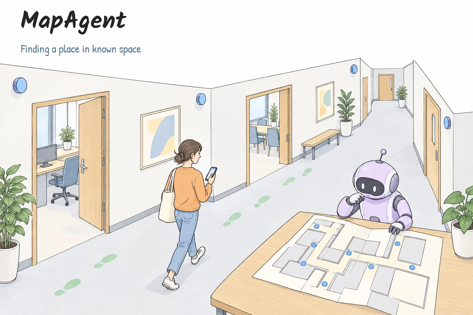
Hand-drawn indoor localisation scene with a person, a floor plan and a small agent
View illustrationEnlarge

Image viewer

100%
1 / 4

Hand-drawn indoor localisation scene with a person, a floor plan and a small agent. Conceptual illustration.

Scroll to pan · + / − zoom · 0 reset · Esc close
Hand-drawn indoor localisation scene with a person, a floor plan and a small agent. Conceptual illustration.

Contents

OverviewHow it worksSelected contributionsResearch status
Contents
OverviewHow it worksSelected contributionsResearch status

Overview

Investigate how agents can interpret indoor spatial evidence to estimate location.

How it works

Given a floor plan and known anchors, MapAgent combines BLE, motion and map evidence to form constrained location candidates. The language-model agent selects a registered candidate or abstains. An independent verifier checks the proposed choice; accepted choices proceed, while abstention or rejection follows a deterministic fallback. Map reachability and motion consistency constrain the candidate set.
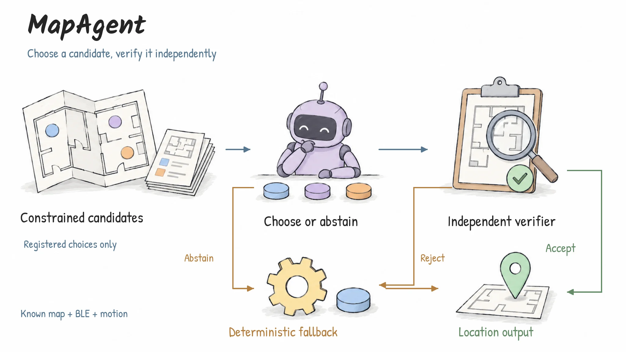
The agent chooses a registered candidate or abstains. An independent verifier accepts a valid choice; abstention and rejected choices use a deterministic fallback.
View illustrationEnlarge

Image viewer

100%
2 / 4

Choose, verify, fall back — The agent chooses a registered candidate or abstains. An independent verifier accepts a valid choice; abstention and rejected choices use a deterministic fallback.

Scroll to pan · + / − zoom · 0 reset · Esc close
Choose, verify, fall back

The agent chooses a registered candidate or abstains. An independent verifier accepts a valid choice; abstention and rejected choices use a deterministic fallback.

AI-assisted method illustration
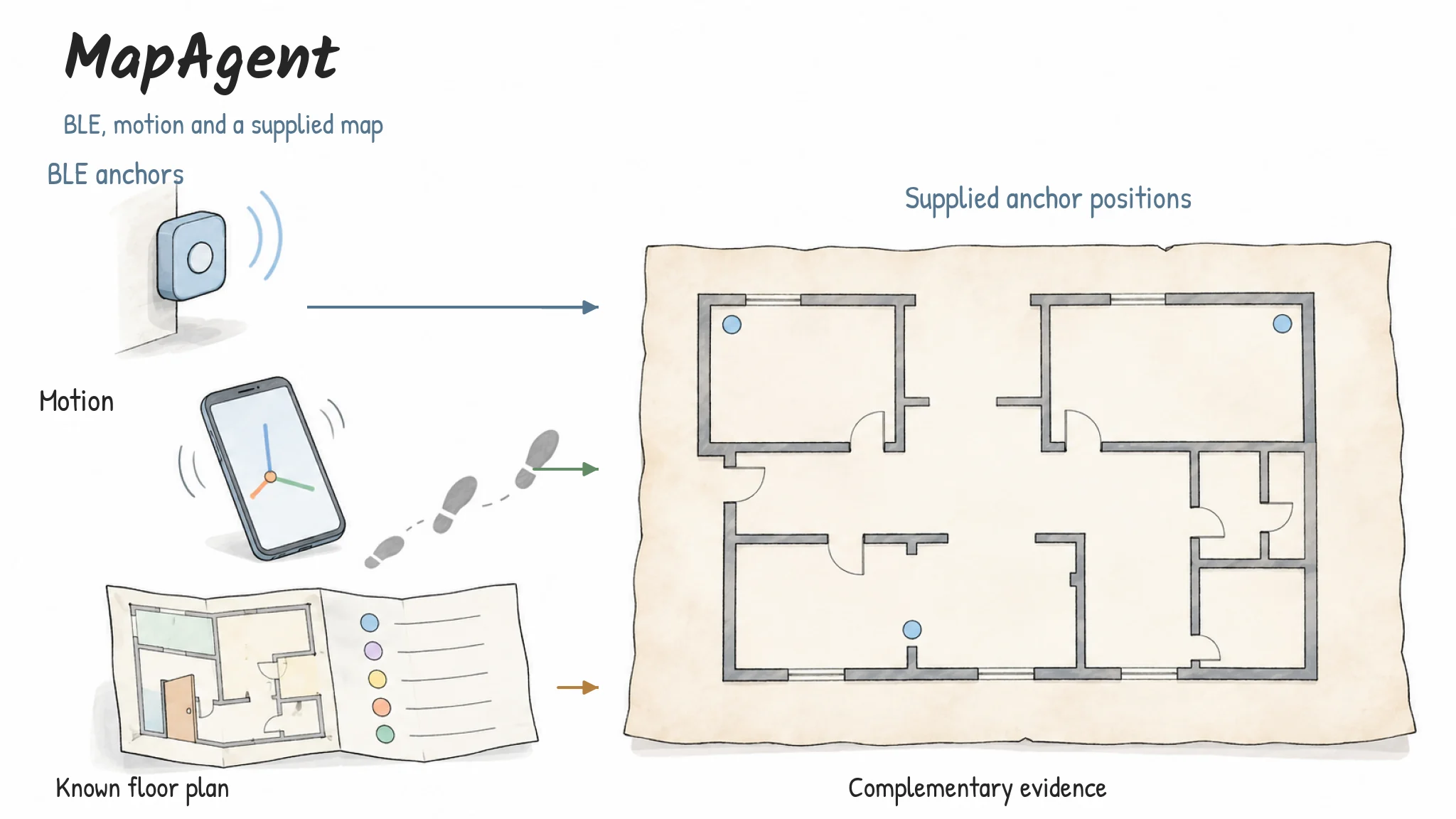
BLE anchors, motion observations and a supplied map contribute complementary evidence. The floor plan and anchor positions are known inputs, not outputs inferred from scratch.
View illustrationEnlarge

Image viewer

100%
3 / 4

Three sources of spatial evidence — BLE anchors, motion observations and a supplied map contribute complementary evidence. The floor plan and anchor positions are known inputs, not outputs inferred from scratch.

Scroll to pan · + / − zoom · 0 reset · Esc close
Three sources of spatial evidence

BLE anchors, motion observations and a supplied map contribute complementary evidence. The floor plan and anchor positions are known inputs, not outputs inferred from scratch.

AI-assisted method illustration
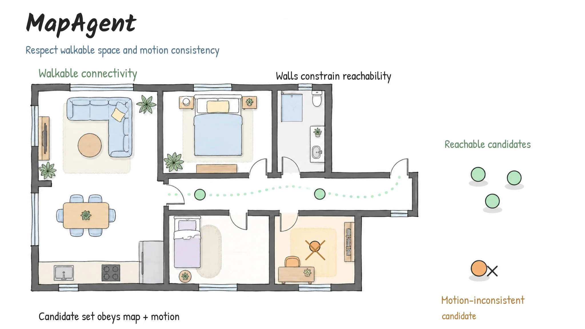
A conceptual floor plan illustrates how walls, connected walkable space and motion consistency restrict location candidates. It does not reproduce any evaluation site.
View illustrationEnlarge

Image viewer

100%
4 / 4

Candidates that respect the map — A conceptual floor plan illustrates how walls, connected walkable space and motion consistency restrict location candidates. It does not reproduce any evaluation site.

Scroll to pan · + / − zoom · 0 reset · Esc close
Candidates that respect the map

A conceptual floor plan illustrates how walls, connected walkable space and motion consistency restrict location candidates. It does not reproduce any evaluation site.

AI-assisted method illustration

Selected contributions

  • Developed a localisation agent using BLE, motion and map information.
  • Evaluated localisation performance across six sites and 41 trajectories.

Research status

Ongoing final year project on indoor localisation and spatial reasoning.

Next Project

MetroHeight

Zhengyang Wang

Computer Science and Technology · BNBU

EmailGitHubCVPersonal Profile
© 2026 Zhengyang Wang · 王正旸Built on Magic UI PortfolioBack to top ↑